The first picture is from 11 am CDT and the second is just 6 hours later at 4 pm CDT.
You can see the dry air pushing across Kansas and about to collide with the warm, moist air to the east.
I drew some more isodrosotherms - in 3 different colors to show you more of a contrast. The black line is 50+ dew points, the green is 60+, and the red pockets are 65+ dew points. The highest I found was a 70 degree dew point in north-central Oklahoma.
I attempted to draw numbers this time too.
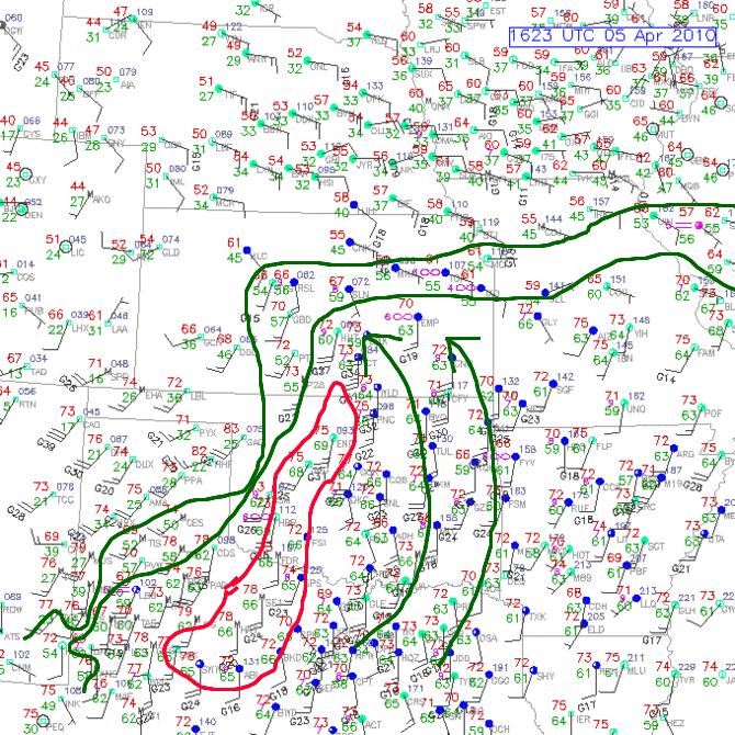

The front you see extending from the low in Kansas and over toward Chicago and Detroit is a warm front. This boundary seperates warm moist air to the south from cooler, drier air north of it.

No comments:
Post a Comment