Monday, October 29, 2012

Sandy's Continental Connection


This graphic from the NWS Alaska Region web site shows how cold Arctic air is affecting the development of the massive east coast storm. This cold air is being drawn into the storm circulation's southwestern quadrant, helping to maintain the storm intensity over land now that it is not tropical in nature. One of the mechanisms that drives cyclone development is large temperature differences. That is why we often have strong mid-latitude storms in the spring and fall - the transition periods between summer and winter when temperature contrasts can be large. The cold air drawn in to the west side of the current storm is producing the winter storm conditions over West Virginia, Virginia, and western North Carolina.  CoCoRaHS observers in those areas were already reporting snow starting to fall this morning. Here is a map of the latest watches and warnings from the Charleston, WV National Weather Service office. Two feet of wet snow is expected at the highest ridge tops in the central Appalachians.


As of 7:00 p.m. EDT the eye of now post-tropical storm Sandy was about 20 miles off the southern New Jersey coast. The storm had weakened slightly from earlier today, but still packs a knockout punch.

Radar mosaic for the northeastern U.S. at 6:58 p.m. EDT

Sunday, October 28, 2012

The Start of a Long Week in the Eastern U.S.

Even though Sandy still remains almost 300 miles east of Cape Hatteras, NC as of 11:00 p.m. EDT, her effects are being felt up and down the eastern seaboard.

Position of Hurricane Sandy and forecast track as of 11:00 p.m. EDT October 28
The footprint of this storm is huge, and extends from the Outer Banks all the way to Bermuda. The orange area in the map below is the area being affected by tropical storm force winds (>=39 mph).


Rain bands associated with Hurricane Sandy are already soaking the mid-Atlantic coast from New Jersey south to the Outer Banks of North Carolina and east into Virginia.

Radar image from the Dover AFB radar at 11:12 p.m. EDT October 28, 2012


Strong winds are being recorded as far north as Nantucket, MA, where northeast winds are sustained at 20 mph and gusting to 35 mph at 11:00 p.m. EDT. At Norfolk, VA winds are north at 24 mph gusting to 39 mph. The weather will continue to go downhill tonight from Virginia to southern New England.

Warnings, watches, and advisories of just about every variety cover the eastern third of the country because of Sandy and the eventual "morphed" monster it will become in the next 24 hours. High wind watches are in affect for areas as far west as Lake Michigan. Winter storm watches are in effect for the high elevations of southeastern West Virginia, southwestern Virgina, and western North Carolina, where 4 to 8 inches of snow may accumulate. High wind warnings are in effect or will be in effect for coastal areas from Virginia to Maine, with winds expected to gust to 50 to 60 mph over a period of 18 to 36 hours.

The NWS watch/warning map as of 11:39 p.m. EDT October 28.

This storm is going to affect a large number of our CoCoRaHS observers. We of course will appreciate any reports you can provide during the week. However, your safety and the safety of your families comes first, so do not take any unnecessary risks to make an observation. With power likely to be out for a large area of the east for anywhere from a day to perhaps more than a week, many of you will not be able to send in any observations you may be able to make. Your fellow CoCoRaHS observers across the country are hoping that all of you affected by the storm come through this safely and with minimal damage.


Thursday, October 25, 2012

East Coast Bracing for a Big Storm

It appears the ingredients for a major East Coast storm will be coming together early next week. Hurricane Sandy has been in the news the past few days, and it is affecting the Bahamas tonight after leaving 11 dead in Cuba. In addition to Sandy, as if that weren't bad enough, forecasters are closely following the development of a strong low pressure trough aloft that could interact with Sandy early next week, and not in a good way. Forecasters saw this possibility as early as Sunday and it's been something forecasters across the county have been watching closely.  This potential storm was the highlight of a forecast discussion from the National Hydrologic Prediction Center earlier today. I'm not sure if this is where the name "Frankenstorm" first appeared, but the name has now taken on a life of it's own in the media.

EXTENDED FORECAST DISCUSSION
NWS HYDROMETEOROLOGICAL PREDICTION CENTER COLLEGE PARK MD

313 PM EDT THU OCT 25 2012
VALID 12Z SUN OCT 28 2012 - 12Z THU NOV 01 2012

...HIGH IMPACT MERGING OF ENERGETIC SYSTEMS ANTICIPATED OFF THE
MID ATLANTIC COAST...


PRELIMINARY UPDATE...

DESPITE A MODEST CLUSTER OF OUTLYING DETERMINISTIC SOLUTIONS AND ENSEMBLE MEMBERS FROM THE VARIOUS MODELING CENTERS, THE LION'S SHARE OF GUIDANCE INDICATES THAT THE CIRCULATION ASSOCIATED WITH HURRICANE SANDY WILL PASS CLOSE ENOUGH TO THE AMPLIFYING POLAR TROUGH OVER THE EASTERN UNITED STATES TO BECOME INCORPORATED INTO A HYBRID VORTEX OVER THE MID ATLANTIC AND NORTHEAST NEXT TUESDAY. THE HIGH DEGREE OF BLOCKING FROM EASTERN NORTH AMERICA ACROSS THE ENTIRE ATLANTIC BASIN IS EXPECTED TO ALLOW THIS UNUSUAL MERGER TO TAKE PLACE, AND ONCE THE COMBINED GYRE MATERIALIZES, IT SHOULD SETTLE BACK TOWARD THE INTERIOR NORTHEAST THROUGH HALLOWEEN, INVITING PERHAPS A GHOULISH NICKNAME FOR THE CYCLONE ALONG THE LINES OF "FRANKENSTORM", AN ALLUSION TO MARY SHELLEY'S GOTHIC CREATURE OF SYNTHESIZED ELEMENTS.


 "Blocking" refers to the effect of high pressure to the north of the two low pressure systems preventing them from moving toward the northeast in this case. Here is what the potential interaction looks like on the upper air forecast charts.


This is the forecast 500 millibar map for 2:00 p.m. EDT Monday, October 29, 2012.

There are several reasons East Coast residents should be taking notice. Hurricane Sandy will be drawing large amounts of moisture from the Atlantic inland, setting the stage for widespread flooding. The polar trough approaching from the west will be accompanied by cold air which help maintain some intensity of Sandy, even after she loses tropical characteristics.  In addition, the storm will be moving very slowly because of the blocking high to the northeast. The large difference in pressure between the blocking high and the cyclone will produce sustained high winds that will damage trees and power lines.That means East Coast residents will be dealing with this for not just hours, but days. As of 11:00 p.m. EDT on October 25th. the expected forecast track of Hurricane Sandy will bring her ashore somewhere in southern New Jersey Tuesday morning. 


For the latest updates on Hurricane Sandy see the National Hurricane Center website.  Be sure to check your local NWS office website for updated forecasts for your specific area.

Friday, October 19, 2012

Big Change Ahead


500 millibar map (about 20,000 ft) for 7:00 p.m. CDT October 18
This weekend will mark the start of a significant change in the weather pattern across the U.S
Right now the eastern half of the country is chilly as a large upper low spins over the area. Out west, it has been very warm recently under an upper level ridge. Temperatures, for example, in northern California have been in the upper 80s and low 90s. Yesterday new high temperature records were set in San Francisco and Oakland.


RECORDS SET...

 LOCATION                NEW RECORD   OLD RECORD AND YEAR
 --------------------------------------------------------
 SAN FRANCISCO AIRPORT     86           85         1988
 OAKLAND DOWNTOWN          87           84         1974
 OAKLAND AIRPORT           87           83         1974
 MOUNTAIN VIEW             89           87         1995


A number of daily temperature records have been set in southern California as well. On Wednesday El Cajon reached 102°F, breaking the old record of 96°F set in 1996.

As this weekend progresses, the pattern will shift as the upper low lifts out of the Midwest, and a strong trough develops off the west coast.

Forecast 500 millibar map for 7:00 a.m. CDT Sunday, October 21.

What's this mean? Well, the central and eastern U.S. will enjoy a period of mild fall weather. October so far has been cooler than normal from the Rockies eastward, and near to above normal west of the Rockies.


The west coast, from Washington south through northern California, will be in for a period of stormy, cool weather.


Do you have a question you would like answered or suggestions on topics you would like to see in future blog posts?  Feel free to email me your questions and suggestions at hberg74@gmail.com

Wednesday, October 17, 2012

A Stormy Season Down Under

Vehicles stranded on road west of Sydney, Australia
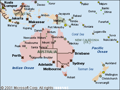
Both Australia and New Zealand are still dealing with winter weather well into their spring. This past weekend a strong spring storm brought heavy snow to parts of Australia and heavy rain and snow to New Zealand's South Island.  The heavy snow near Sydney stranded more than 300 motorists and knocked out power to 2500 homes.

Four inches of snow and almost six inches of rain in 24 hours in South Island stranded travelers and caused flooding.  The storm, which came in from the Tasman Sea, caused high winds and power outages in Auckland and triggered a massive landslide that sent huge boulders crashing down on roads.

Surface weather map for 5:00 p.m. Australian EDT October 12, 2012.


If you are interested in learning more about the weather down under, check out the following web sites:

Australian Meteorological Bureau

Meteorological Service of New Zealand

Tuesday, October 9, 2012

Fire and Ice

Last week a strong storm system dropped 12 inches of snow in northwestern Montana and 12 to 14 inches of snow in northwestern Minnesota. A number of daily snowfall records were set in both states.

Snow depth on the morning of October 6, 2012.
Map from the National Operational Hydrologic Remote Sensing Center

The snow in northwestern Minnesota was particularly beneficial. It fell on an area of the state where two large wildfires have been burning since early September. The snow helped knock down the fire on the surface, but the fires are now burning layers of peat underground.

While some good rain and snow events have chipped away at drought in the eastern half of the country, the western U.S. is still suffering from long-term dry conditions. Numerous wildfires are still active, especially in Washington, Oregon, Idaho, and Montana. The largest fire is the Mustang Complex in Idaho, consisting of six fires and encompassing more than 340,000 acres.


This shows the location of fires on October 9 using NOAA satellite data that detects fires and smoke.
Map based on data from the NOAA Satellite and Information Service.

This could be a record year for wildfires in the United States. The current record is 9.8 million acres burned in 2006.  As of October 4, the National Interagency Fire Center reports that more than 8.8 million acres have burned from more than 49,000 wildfires. Idaho has been the state hit the hardest in terms of acres burned with 1.73 million acres affected.

The spectacular fires early this season in Colorado made the national headlines largely because they affected heavily populated areas. However, the wildfire season continues.


This afternoon, a new fire ignited in Rocky Mountain National Park west of Estes Park, Colorado. AS of 5:30 p.m. MDT the fire was 300 acres and was rapidly spreading in steep terrain,


Wednesday, October 3, 2012

Winter Weather Hits Northern Rockies and Plains

Record snowfall occurred in Montana today, and snow will likely fall across the parts of the Dakotas and Minnesota through Thursday.

Snow accumulations in the Rocky Mountain front in northwestern Montana ranged from 11.0 inches in Teton County to 7.0 inches in Glacier County, and from 1.5 to 5.0 inches further south. Billings received 2.3 inches of snow, breaking the old record for October 3 of 1.3 inches in 1991.

Residents of northeastern North Dakota to northwestern Minnesota will wake up to heavy snow and strong winds causing blizzard conditions at times. Six to 12 inches of snow are expected  to accumulate by Thursday night.  Winter storm warnings are in effect, and further to the east Winter Weather Advisories are in effect for most of North Dakota.

This is the watch.warning map for 11:25 p.m. October 3. The pink shading indicates
Winter Storm Warnings, and the purple indicates Winter Weather Advisories.


Sunny and cool weather is expected over the weekend, so any accumulated snow will be melting throughout the week. Despite the inconvenience of the early winter weather, the precipitation is very welcome.  Precipitation has been less than 50 percent of normal in the Northern Plains since July 1.

The storm is a an early reminder to those CoCoRaHS observers in snow country that it's a good time to start reviewing snow measurement procedures in preparation for the coming winter.

Monday, September 24, 2012

A Chilling Mid September

Frost and freezing temperatures have made an early appearance in the central and northeastern U.S. this year.  Last week's strong cold front that swept through the central U.S. brought the first freezing temperatures to the Midwest as far south as southern Wisconsin  Another sprawling cold air mass spilled south across much of the country east of the Rockies this weekend ending the growing season for many locations as far south as northern Missouri Sunday morning. Last night frost warnings were in effect for eastern Wisconsin, all of Illinois, Indiana, and Michigan (except areas close to the Great Lakes), and parts of Ohio, Pennsylvania, New York, Maine, West Virginia, Virginia, and North Carolina.

The areas in blue indicate the frost advisories in effect for Sunday night, September 23rd.
Low temperatures this morning reached the low to mid 30s south to the Ohio River, and frost was noted on the grass and rooftops in many areas.  On nights with strong radiational cooling, the vertical temperature gradient can be rather steep. The temperature at grass level can be degrees lower than the temperature at five feet, the approximate height of temperature sensors. If the temperature at sensor level is 33°F, the temperature right at the ground can be below freezing.  Even on such days, there may not be much damage to plants.  Damage to plants depends not only on whether or not it is below freezing, but how long the temperature is below freezing.

Minimum temperatures for the morning of September 24.

The colored dots on the map indicate locations where 32°F has occurred this fall.


The first occurrence of 32°F is about on schedule for the upper Midwest and Northern Plains, and anywhere from a week to two weeks early in the central U.S.  The temperatures in the low and mid 20s are a few weeks early.  The maps below show the extend of freezing weather so far this fall n the central U.S., and the median dates for the first occurrence of 32°F and 28°F.


This map shows the median date of the first occurrence of 32°F in the central U.S. Within a range, the earlier dates typically occur in the north and the later dates in the south. However, terrain and surrounding land use can have a significant influence on overnight low temperatures.

Same as the map above, except for 28°F.

Tuesday, September 11, 2012

September 11th

As I was on my way in to work this morning it struck me how much today's weather here in central Illinois was like that on the morning of September 11, 2001, one I distinctly remember as many of us probably do.  Today most of the country on the CoCoRaHS precipitation map is showing zeroes, and here in Illinois it was a cool, clear early fall morning without a cloud in the sky.  In 2001 our morning low was 54°F, this morning it was 51°F. The high temperature in 2001 was 82°F, and that's about our forecast high for today.

I thought I would take a look at the Daily Weather Maps for both days, and was amazed at how similar they are.  The map for this morning is about 12 hours "ahead" of the map for 9/11/01.

The surface weather map for 7:00 a.m. EST on September 11, 2001
The surface weather map for 7:00 a.m. EST on September 11, 2012

What started as a magnificent fall day in 2001 turned into a day of horror, shock, sadness, and grief.  As you enjoy the weather on September 11, 2012, pause to remember the victims and heroic efforts of those who risked and lost their lives on 9/11.

Thursday, September 6, 2012

Thanks, Isaac!

Hurricane Isaac caused a lot of grief and damage in Louisiana and Mississippi, mostly from the heavy rain and flooding. However, the heavy rains with the remnants of Issac were most welcome in the central U.S. despite the fact they made for a soggy Labor Day weekend.

Most of the Midwest received from two to more than seven inches of rain from Isaac. However, the amount of rain depended greatly on whether or not your gauge happened to be underneath one of the heavier bands of showers and thunderstorms rotating around the center of Issac.

As you might expect, Isaac gave the drought a good kick in the teeth from Missouri eastward. If you compare the U.S. Drought Monitor of August 28 to that of September 4 the areas of improvement are clearly apparent. One thing to note, however, is that "islands" of Severe and Exceptional Drought (darker reds) persist within the larger areas of improvement.  These "islands" are a reflection of the banding of showers and thunderstorms in Isaac's circulation in which some areas received much less rain than areas not far away..


This is an animation created from maps of 24 hour precipitation amounts from
August 31 through September 3, 2012. The maps in this animation
are from the NWS Advanced Hydrologic Prediction Service.


Note that while Issac improved the drought situation by one to two categories in some areas, Severe to Exceptional drought is still firmly entrenched over much of the central U.S.


Thursday, August 30, 2012

Midwest Braces for Isaac's "Leftovers"

Late this afternoon Tropical Depression Isaac was located near the Louisiana/Arkansas line. moving in a northerly direction at about 12 mph, twice the speed it was moving yesterday.  Isaac left up to 20 inches of rain behind in Mississippi and Louisiana, and those areas can expect more rain in the next two days. CoCoRaHS observers in Hancock County, MS near Kiln reported 24-hour rainfall totals of 14.18 and 13.89 inches. This was on top of 2.8 inches received the day before. In Tangipahoa Parish in Louisiana the CoCoRaHS observer at LA-TG-2 near Hammond reported 11.00 inches this morning. Observations in southern Louisiana were few and far between because of the flooding and power outages.
This is a map of the 24 hour precipitation accumulation produced by combining radar and rain gauge measurements. Source: NWS Advanced Hydrologic Prediction Service

Now the Midwest is bracing for Isaac's rain.  A flash flood watch is in effect for much of Arkansas, and will probably be extended through Missouri and Illinois tomorrow and Saturday. The forecast track of Isaac has varied a little over the last 24 hours, but the axis of heavy rain is still likely to be an area from Arkansas through most of Missouri, Illinois, Indiana, and Ohio. Generally 3 to 6 inches of rain can be expected, with some locations receiving more. Some of the squalls will be accompanied by strong gusty winds, and a few severe thunderstorms are not out of the question.

Forecast track for Isaac issued at 4:00 p.m. CDT
Quantitative precipitation forecast for August 30-September 4

Wednesday, August 29, 2012

Tropical Rain, and Lots of It

Deep tropical moisture along the southeast coast of the U.S. has been responsible for torrential rains in areas far removed from Hurricane Isaac.  For the 24 hour period ending on August 28th the heaviest rain was found along the central east coast of Florida.  CoCoRaHs observers in Indian River, St. Lucie, and Martin Counties reported seven to more than 10 inches of rain for the 24 hours ending Tuesday morning, with the CoCoRaHS observer at FL-IR-32 in Vero Beach reporting 10.50 inches of rain.

Rainfall for the 24 hour period ending Tuesday, August 28, 2012 in Florida


Yesterday the heavy rainfall fell along the South Carolina coast, with CoCoRaHS observers north of Charleston, SC reporting four to more than 6 inches of rain.   6.80 inches was reported this morning by the observer at SC-CR-46. A flash flood watch is in effect for the Charleston area through tonight with more rain expected.

Rainfall for the 24 hours ending the morning of Wednesday, August 29, 2012 in Charleston, SC


Meanwhile, Isaac continues his agonizingly slow crawl to the north and west through southern Louisiana. In the past 14 hours Isaac has moved only about 75 miles. As of 10:00 CDT this morning Isaac was still a minimal hurricane with gust over 80 mph measured in some areas. Isaac is pretty impressive on radar and exhibits a distinct but somewhat ragged eye. Radar estimated rainfall is almost 12 inches east of the storm center as of noon CDT.  With Isaac moving only at about 5 mph, much more rain can be expected the rest of today.

Radar estimated rainfall for the Gulf Coast at 12 noon CDT, August 29, 2012.

Hurricane Isaac as seen from the New Orleans, LA radar at 12 noon CDT, August 29, 2012

Tuesday, August 28, 2012

Isaac Pounding Gulf Coast

Hurricane Isaac has made landfall once already, moving over the Mississippi River delta shortly before 7:00 p.m. CDT August 28, but has since moved back out over the water. He is expected to make landfall again near Grand Isle, Louisiana later tonight.  Here is the radar image of Isaac as of 9:52 p.m. CDT tonight (August 28). 

Hurricane Isaac just off the coast of Louisiana, 9:52 p.m. CDT August 28  
 Isaac is "just" a Category 1 storm with top winds of 80 mph. However, it is producing dangerous storm surge from the Mississippi River Delta eastward.  Isaac's slow movement means that the Gulf coast will deal with prolonged high winds and very heavy rain. The NWS Hydrometeorological Prediction Center's latest 5-day quantitative precipitation forecast paints an impressive amount of rain from the Gulf Coast northward through the southern half of the Midwest as Isaac moves slowly northwest inland and then turns north and northeast.


CoCoRaHS observers across the central and southeastern U.S. will be getting a lot of practice measuring rainfall the next several days. In much of the Midwest there could be more rain the last week of August than fell in all of June and July.  In my post on July 31 I suggested that the central U.S. would love to see a tropical system bring it's rain to drought stricken areas, but that it was probably a long shot. Maybe I should buy a lottery ticket!


Thursday, August 23, 2012

A "Warm Up" for Isaac?

On Tuesday and Wednesday more than nine inches of rain fell in southern Pinellas County, Florida. On the morning of August 22 two CoCoRaHS observers in South Pasadena (west of St. Petersburg). Both reported more than seven inches of rain, and added another 1.50 inches by the morning of August 23. Station FL-PN-17 measured 7.95 inches on August 22 and 1.60 on August 23 for a two-day total of 9.55 inches.  Station FL-PN-6 measured 7.07 and 1.45 inches on th two days for a total of 8.52 inches. At station FL-PN-17 4.27 inches fell in the first 80 minutes of the storm! The thunderstorms were part of a complex of storms that moved from the Gulf east across central Florida.
Rainfall in Pinellas County, FL for the 24 hour period ending the morning of August 22, 2012
Buckets of rain could be in the cards for the Tampa area and western Florida early next week depending on the track and intensity of now Tropical Storm Isaac. The latest path projection takes Isaac into the western Gulf of Mexico. If that's the case the west coast of Florida will be in for some significant wind and rain.  In the meantime, the Tampa area will be generally dry the next couple of days as winds swing into the northeast cutting off the flow of moisture from the Gulf of Mexico.


Position and projected track of Tropical Storm Isaac as of 8:00 p.m. EDT August 23, 2012

Thursday, August 16, 2012

Record Heavy Rain in Alaska

While almost 62 percent of the lower 48 states deals with drought conditions, a series of storms systems have dumped excessive amounts of rain on northwestern Alaska so far this week. Amounts in excess of five inches have been recorded so far, with 5.0 inches at Red Dog Mine, 3.50 inches of rain at Kivalina and 2.50 inches a Kotzebue. Northwest Alaska is a relatively dry region, and the amounts received this week amount to about one-third of the average annual precipitation. In this region, a three inch rainfall in three days is a once in a hundred year event!

Image courtesy of NWS Alaska Region

The heavy rain has caused flooding and river levels are expected to remain high the rest of the week. Two more storm systems are forecast to hit the area in the next two to three days producing additional rainfall one one to three inches.

Weather map for Thursday, August 16.  Source: NWS Anchorage, AK
Forecast map for Saturday, August 18, 2012.  Source: NWS Anchorage, AK
Interestingly, it has been dry in central southern Alaska.  Anchorage has received only 0.61 inches of rain so far this month, with a normal August total 3.30 inches.  Fairbanks, with an average total of 1.88 inches in August, has only mustered 0.13 so far this month.

Most of our CoCoRaHS stations in Alaska are in and around Anchorage. A couple of the Anchorage CoCoRaHS stations have recorded a little over an inch for the month, but as is typical during the summer, precipitation can vary a lot over a small distance, even in Alaska.

Thanks to colleague Sam Shea for the "heads up" on this unusual event.